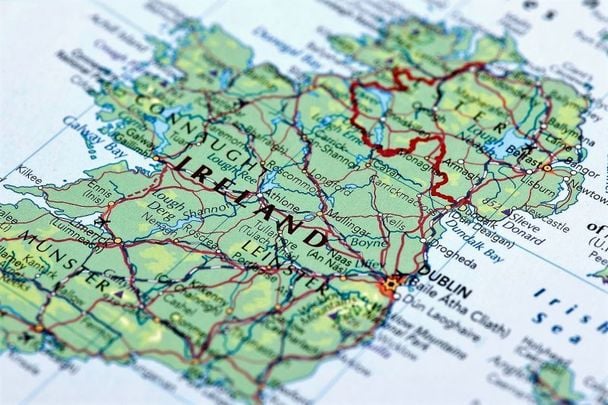
Roughly the size of Indiana, the island of Ireland is so small it will shock you!
An island in the eastern part of the North Atlantic, Ireland, taking in the Republic and Northern Ireland is not as big as you'd think.
Area of Ireland
Ireland covers an area of 84,421 square kilometers (32,595 square miles).
To put that into perspective that's slightly larger than the State of West Virginia. Indiana is only slightly larger at 35,910 square miles in area. Even more insanely you could fit 202 Irelands into the country of Russia. It's that small.
North to south, it's 486 km (302 miles) long and 275 km (171 miles) wide, going east to west.
You can drive from Malin Head, the most northerly point, to Mizen Head, the most southerly point, in less than eight hours.
If you drove from Moscow to Vladivostok in Russia that would take 115 hours. Or it would take 53 hours to drive from Sumas, in Washington, to Key West, in Florida.
Ireland also has 3,172 kilometers (1,970 miles) of coastline. Of course, this includes the Wild Atlantic Way, one of the world's longest defined coastal route in the world, at 1600 miles (2600 km).
Population of Ireland
The population of the island of Ireland is about 6,846,036million (The Republic of Ireland - 4,937,786 million, Northern Ireland - 1,908,250 million).
Again a bit of perspective. The population of Indiana is about 6 million. Turkmenistan, Tajikistan and Kyrgyzstan all have larger populations than Ireland.
Location of Ireland
Just in case you were in any doubt about its location (you'd be surprised), it's the westernmost island in Europe, west of the United Kingdom. Its official location is 51.5 degrees and 55.5 degrees north latitude and 5.5 degrees and 10.5 degrees west longitude.
Ireland is bounded to the north by the North Channel, which separates it from Scotland and on the east and southeast by the Irish Sea and St. George's Channel, which separates it from England and Wales. To the west from north to south, the coast is washed by the Atlantic Ocean.
Ireland's highest, largest, longest
Ireland's highest mountain is Carrauntoohil (1,038 metres), in County Kerry.
The second highest mountain is Beenkeragh (1010 metres), County Kerry.
The tallest waterfall is Powerscourt Falls, County Wicklow, where the water drops 106 metres (350 feet).
The longest river in Ireland is the River Shannon, measuring 386 km (240 miles).
The largest lake is Lough Neagh, Northern Ireland, which is 396 km² (153 miles²) in area.
* Originally published 2020, updated in May 2024.

Comments