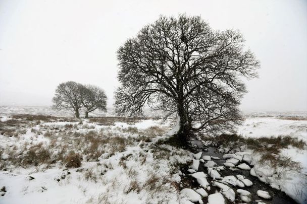
Parts of Ireland are still bailing out from higher than average rainfall
A snow and ice warning has been issued by Met Éireann for the whole of Ireland through Wednesday morning. The new warnings come as parts of Ireland are struggling with flooding.
Read More: Storm Dennis lashes Ireland with 75 mph winds
On February 25, Met Éireann, Ireland’s national meteorological service, had two warnings in place, a snow/ice warning for the entire country, and a wind warning for counties in the southwest of the country. Later in the day on Tuesday, the weather service added a snow and ice warning for parts of the northeast effective Wednesday morning:
Status Yellow - Snow/Ice warning for Ireland
Wintry showers, mainly of hail and sleet, will become increasingly widespread during Tuesday leading to icy patches. Some snow accumulations will also occur.
Valid: 6 am Tuesday, February 25, 2020, to 9 am Wednesday, February 26, 2020
Issued: 2 pm Monday, February 24, 2020
Status Yellow - Wind warning for Clare, Cork, and Kerry
Northwest winds will reach mean speeds of 50 to 60km/h with gusts of 90 to 100 km/h. Strongest gusts associated with showers.
Valid: 2 pm Tuesday, February 25, 2020, to 11 pm Tuesday, February 25, 2020
Issued: 2:39 pm Tuesday, February 25, 2020.
Status Yellow - Snow/Ice warning for Donegal, Leitrim, and Sligo
Showers of hail, sleet, and snow continuing throughout Wednesday and early Thursday, leading to icy patches. Some snow accumulations over high ground.
Valid: 9am Wednesday, February 26, 2020 to 12 pm Thursday, February 27, 2020
Issued: 5 pm Tuesday, February 25, 2020
Met Éireann additionally had two marine warnings in place:
Status Yellow - Gale Warning
West to Northwest winds will reach gale to strong gale force today and tonight on coasts from Hook Head to Loop Head to Rossan Point.
Status Yellow - Small Craft Warning
Westerly winds veering Northwest will reach force 6 or more at times today and tonight on coasts from Rossan Point to Fair Head to Hook Head.
Read More: Weather warnings in place in parts of Ireland ahead of Storm Dennis
Flooding in Ireland
The weather warnings come as Ireland has experienced higher-than-average rainfall throughout the month of February.
In a weather report for farmers issued on February 25, Met Éireann said: "There has been little respite from the rain in the last 7 days, with very wet days in large parts of the country on Wednesday 19th, Friday 21st and Saturday 22nd February. This has resulted in rainfall accumulations this week of between 2 and 5 times the normal weekly rainfalls for the time of year, with the middle third of the country worst affected.
"The wettest weather station this week was Knock Airport which recorded 98.8 mm of rain, 391% of its average. Gurteen in Co. Tipperary had 78.3 mm in the last 7 days, which is 484% of its average amount.
"The driest stations were Johnstown Castle in Co. Wexford with 40.4 mm and Roaches Point in Co. Cork, where 33.1 mm was tallied, which equates to 229% and 184% of their respective normal.
"The next few days will see wintery showers pushing in from the Atlantic from the west. As a result, forecast precipitation amounts will be above average in the western counties and the midlands, which will see 1 to 2 times the normal.
"Further away from western coasts, where these showers will struggle to penetrate such as the east and south, but combined with the persistent spell of rain expected on Friday, it is still expected that these areas will record at least the normal amounts of rainfall for the time of year.
"As river levels remain elevated and soils waterlogged any further heavy rainfalls this week will add to the risk of flooding."
Connacht Irish Farmers Association chairman Pat Murphy said: “We need one authority to set water levels on the river. Enough reports have been done. We need action on this.”
Read More: More weather warnings for Ireland in the wake of Storm Ciara
The flooding has forced Iarnród Éireann to offer bus services on affected routes:
Update: Due to rising water levels, Bus transfers remain in place until further notice between Gort - Athenry on the Limerick/Galway route. Rail services operating between Limerick - Gort and Athenry-Galway. https://t.co/E7fWIpbxl0
— Iarnród Éireann (@IrishRail) February 25, 2020
Carlow Weather shared these images of flood-affected areas:
Drone video over the Barrow this morning. pic.twitter.com/utPMozcAes
— Carlow Weather (@CarlowWeather) February 25, 2020
Shannon Harbour, Co Offaly:
The road to Shannon Harbour, Co Offaly. Those white things swimming across the road are swans #flooding @thejournal_ie pic.twitter.com/0hkUUfzkjr
— Gráinne Ní Aodha (@GAodha) February 24, 2020
Co Kerry:
Road from Castlemaine into Tralee @radiokerrynews @countykerry road could do with being closed.. pic.twitter.com/jW353nUTVr
— Kerry Biker (@cmfoley21) February 24, 2020
Thurles, Co Tipperary:
River burst banks in #Thurles #Tipperary, property at imminent flood risk. I had contacted Tipperary County Council 2 weeks ago, warned them about the river, then I tweeted about it, but no action taken. Typical. #flooding #Ireland #ClimateChange pic.twitter.com/RzkVS03xVT
— Terence Barry AC ?? ?? ?? (@Comdr_ToirAC) February 24, 2020
A GAA pitch completely submerged in Carrick on Shannon:


Comments