Four Met Éireann stations have provisionally reached heatwave status today, Friday, September 8, the Irish Meteorological Service has announced.
A heatwave occurs at a Met Éireann weather station when its daily maximum shaded air temperature is greater than 25°C (77°F) for five or more consecutive days.
Oak Park in Co Carlow, Mount Dillon in Co Roscommon, Gurteen in Co Tipperary, and Shannon Airport in Co Clare have all recorded temperatures higher than 25°C every day since Monday, September 4.
Four Met Éireann stations have provisionally reached heatwave status today. ? ?️
A heatwave occurs at a Met Éireann weather station when its daily maximum shaded air temperature is greater than 25°C for 5 or more consecutive days. ?️☀️ pic.twitter.com/ZYj4cs9QMU
— Met Éireann (@MetEireann) September 8, 2023
The last time heatwaves were observed in Ireland was in August 2022, Met Éireann says.
The longest heatwave of 2022 was observed at Ballincurrig, Co Cork with seven consecutive Summer Days (when a station records a daily maximum temperature of >25°C) from Monday, August 8 to Sunday, August 14 inclusive.
Met Éireann says that there have been three cases of heatwaves in September - two of them in 1991 and one in 1959.
However, this week is the first time it happened with daily temperatures above 28°C (82.4°F) - Mount Dillon on Thursday, September 7, and Oak Park today, Friday, September 8.
The last time a Hot Day (when a station records a daily maximum temperature of >30°C [86°F]) was observed in Ireland was on Sunday, August 14, 2022, at Cloyne in Co Cork.
If a meteorological station observes a Hot Day in 2023, this will be the first time Ireland has observed three consecutive years with Hot Days.
Met Éireann said earlier in the week that the warm conditions in Ireland are due to an area of low pressure to the west of the Iberia which, coupled with high pressure over Scandinavia is advecting warm and humid air over Ireland.
A Status Yellow - High Temperature warning for Ireland has been in place since Wednesday morning, September 6, and is set to continue through 9 am on Saturday, September 9.
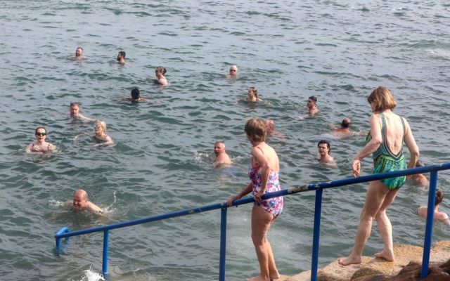
Potential impacts of the high temperatures, Met Éireann said, include heat stress, uncomfortable sleeping conditions, and risk of water-related incidents.
In its national outlook, Met Éireann said on Friday that the weather will be "staying very warm and humid through the weekend with sunny spells and occasional thundery downpours." Temperatures will become cooler from Monday onward.


Comments