
Today, November 17 is Take a Hike Day! Whether you are a seasoned thru-hiker looking for a new challenge, or a newbie to the world of hiking, looking to challenge yourself, Ireland certainly has something for you!
The lads over at Hiiker App helped to put together this list of walks to explore Ireland.
Although a fairly small country, Ireland certainly packs a punch when it comes to hiking trails, having some of the best in the world. With 40-plus National Waymarked Trials, showcasing stunning landscapes and covering over 2,485 miles, this is a country begging to be discovered on foot - if you can tolerate the rain that is!
Known as the Emerald Isle, thanks to its lushness and green scenery, the country has a mild, maritime climate due to the Gulf Stream. This ensures the Irish coastline stays ice-free in winter and keeps the country warmer than other countries at the same latitude, making Ireland a great all-year-round destination for hiking. However, what the country lacks in extremes of temperatures it makes up for with its abundant rainfall and very changeable weather. Be prepared for all four seasons in one day!
Ireland’s spectacular coastline is ringed by mountains and hills, the highest peak is Corran Tuathail (Carrauntoohil) at 3415 feet, while inland is mainly low central plains and bogs. The west coast is rugged with islands, bays, and peninsulas and offers breathtaking vistas. Scattered throughout the land are ancient ruins, stone circles, and other Celtic curiosities, all waiting to be discovered, along with the famous lively culture the Irish are renowned for.
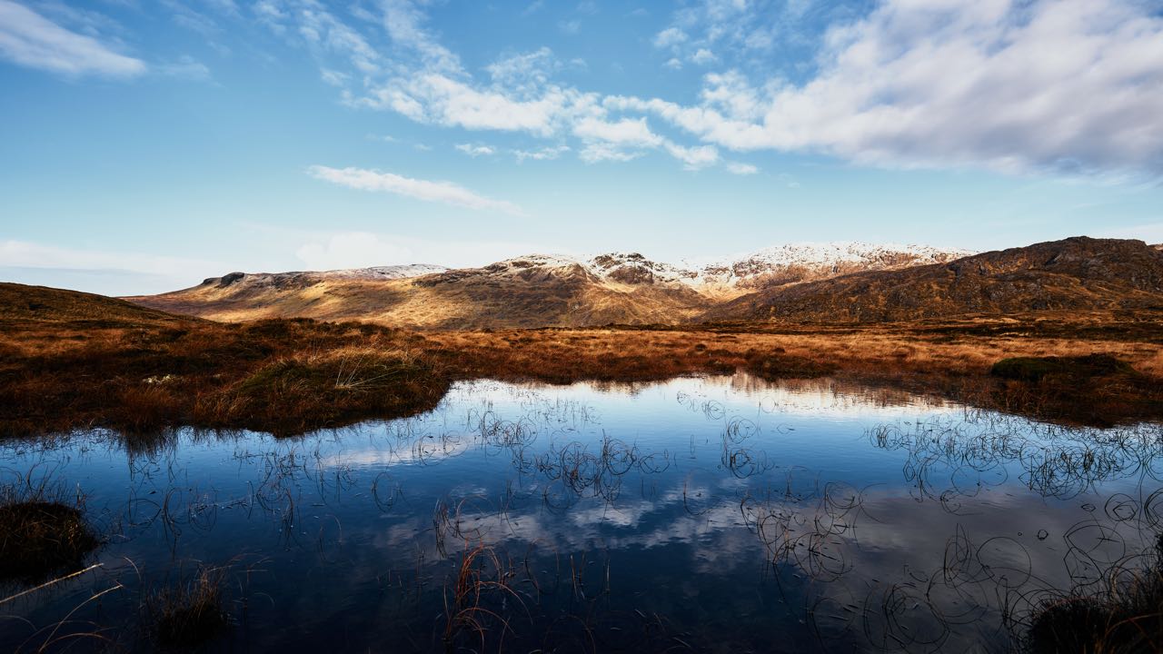
1. The Kerry Way


A view of a beautiful lake in Kerry.
Perhaps one of Europe’s most beautiful long-distance trails, the Kerry Way is a circular hike of 133 miles in the southwest of the country. A popular trail, it begins and finishes in the town of Killarney, voted Ireland’s tidiest and cleanest in 2011. Leading you around the Iveragh Peninsula, the trail passes through a variety of isolated landscapes, low mountain ridges, and enchanted countryside as well as remote villages and market towns.
Accommodation needs to be booked beforehand due to the trail’s popularity. Taking an average of 9 days to complete and easy or moderate for most parts this walk is suitable for beginners with a good fitness level. Overall, expect to climb 17,421 ft in altitude.
2. The Beara Way
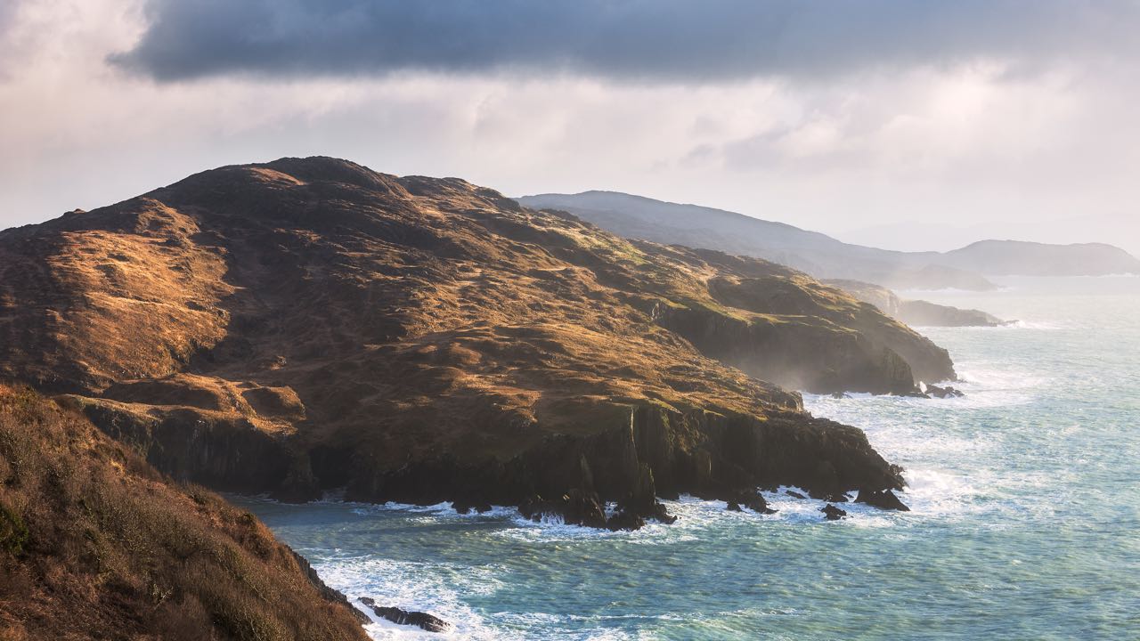
The wild coastline of the Beara Peninsula
The Beara Way long-distance trail closely follows the path of the historical march of Donal O’Sullivan Beare and his one thousand supporters in 1603. This trail is a must for history enthusiasts as there are many heritage sites to be found along its 137 miles; ruins, battlefields, and religious sites, many relating to his march, which ended effectively with him fleeing to Spain.
A circular trail of the Beara Peninsula, there are stunning mountain and coastal parts as well as picturesque towns and villages. Most hikers start and finish in the small seaside village of Glengarriff, which is also a great place for a short stop as it has many things to do on offer, such as kayaking, an annual music festival, and galleries.
Of moderate difficulty, with an elevation of 18054 ft, this trail takes around twelve days to complete.
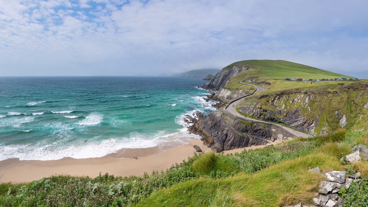
3. The Causeway Coast Way
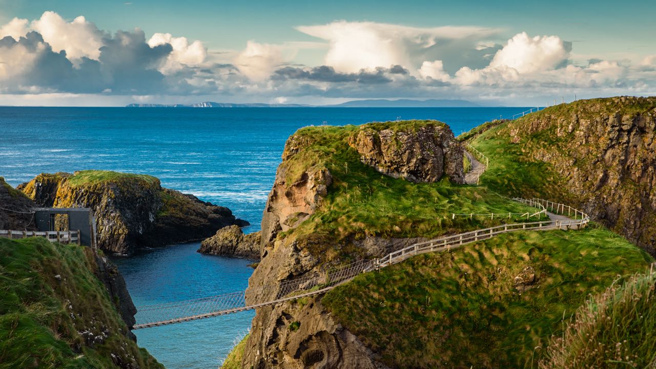
A view of Carrick-a-Rede Rope Bridge just off the Causeway Coast Way
A 32-mile coastal walk in the north-east of Northern Ireland this links the towns of Ballycastle and Portstewart. It is a section of the much longer Ulster Way trail. Good for both beginners and walkers of average fitness alike, navigation skills are not required, being either too remote or too high; the highest elevation is only 459 ft. The trail passes near to some of the famous attractions of Northern Ireland, such as Dunluce Castle, the Giants Causeway, and Bushmills Distillery.
Taking just two to three days, it is an excellent initiation into the world of long-distance hikes and the stunning beauty of the coastal paths ensures that you will not be disappointed.

Are you planning a vacation in Ireland? Looking for advice or want to share some great memories? Join our Irish travel Facebook group.
4. The Wicklow Way
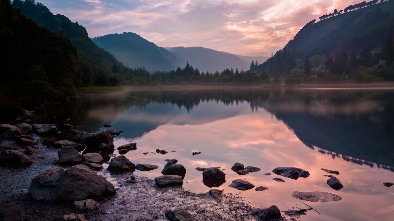
Glendalough Valley
Ireland’s oldest and perhaps most popular waymarked long-distance trail, the Wicklow Way is a linear 81-mile trail crossing the beautiful Wicklow Mountains. Classed as moderate to strenuous, it runs from Marlay Park, about five miles from the center of Dublin, to the village of Clonegal in County Carlow and takes on average a week to complete. It can be walked in either direction, but the north part has more elevation so starting from the south may be more agreeable; your legs will be ready and the prevailing wind is southwesterly, so will be mostly behind you.
The trail, with a total elevation of 10,892 ft, is a mixture of terrain; tracks through fields, forests, quiet back roads, and mountain paths. Along the way, there are many attractions, such as the spectacular glacial valley of Glendalough with its sixth-century monastic village and the impressive Powerscourt Waterfall.
5. Dublin Mountains Way
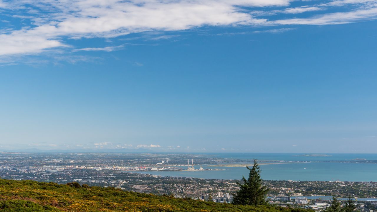
A view of Dublin from the Dublin Mountains Way
Often playing second fiddle to Dublin’s other long-distance trail, the Wicklow Way, the Dublin Mountains Way is great for first-timers. You have the feeling that you are away from it all yet the city of Dublin is never far off; you get some great views of the city on this trail.
Crossing the Dublin mountains, east to west, from Shankill to Tallaght, the trail is 28 miles, takes two days, and is a mix of roads, forests, and mountain trails. There are many interesting things to see along the way, such as prehistoric monuments and places of scientific and conservation interest.
For pub lovers, old Johnnie Fox’s pub in Glencullen will be a welcome pitstop, it’s the highest pub in Ireland and one of the oldest!
6. The Dingle Way
A view of Slea Head from the Dingle Way
Beginning and ending in Tralee, this is a 111-mile trail around the Dingle Peninsula, in the southwest of Ireland. It will take about eight days to complete and the total elevation is 11439 ft. As spectacular as it is popular, the scenery changes at almost every turn; traverse the foothills of Slieve Mish and then stand on the edge of the world at Slea Head overlooking the wild Atlantic Ocean, traipse across open golden beaches and over lush farmland pastures.
Passing through many quaint towns and villages, on day three the stopover is Dingle, Ireland’s foodie town and once cited as ‘the most beautiful place on earth’ by National Geographic. The trail touches some of the finest archeological sites in the country and in Annascaul, the South Pole Inn is a shrine to Tom Crean, the Antarctic explorer born there in 1877.
Easy to moderate, for the most part, it becomes more difficult at the foot of Mount Brandon.
7. The Ireland Way
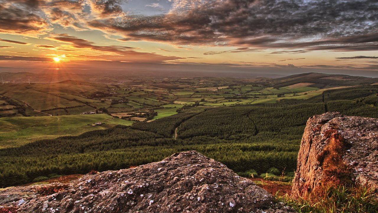
Spectacular sunsets will be plentiful along the 1000km trail
This is Ireland's longest coast-to-coast, going from Killaconenagh in County Cork to Ballycastle in County Antrim, some 600 miles away. Linking the Beara-Breifne Way with the Ulster Way, it is a moderate-difficulty trail with a total elevation of 42,650 ft and takes around 50 days to complete.
Not for the time-poor or the faint-hearted! Accommodation on the route consists mainly of hostels, bed and breakfasts, and campsites; wild camping is usually tolerated provided permission is granted from the landowner. Be sure to get the Ireland Way passport, available in either Glengarriff (the third town in the south) or Ballycastle, as well as a completion certificate at the end.
Along the trail, you will encounter hills and mountain ranges, hike through forests and fields, traverse bogs and walk along coasts, learning a little about Ireland’s fascinating history and culture, as well as sampling its generous hospitality!
8. The Western Way
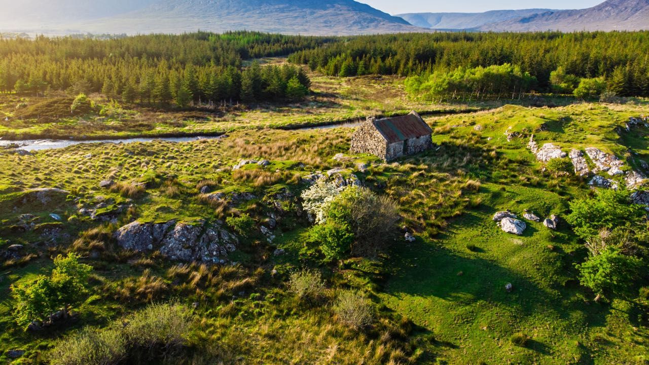
An old cottage along a river in Connacht
This trail begins in the historic village of Oughterard on the shores of Lough Corrib, one of the largest lakes in Western Europe in County Galway and famous for its trout and salmon. There is a lot of heritage to be found here; megalithic tombs, a court tomb, and some monastic ruins.
For history enthusiasts, it is definitely worth exploring before starting on the week-long, 112-mile hike to Ballycastle in County Mayo. Along the trail discover the mythical Connemara with its wild, eerie scenery, a million miles away from the modern world. The Western Way leads you through true Ireland, wild Ireland, with its peat bogs, pristine rivers, and savage landscapes.
An easy to moderate trail, the elevation gain is just under 7000 ft but the weather here is famous for being wet and windy.
9. The Slieve Bloom Way
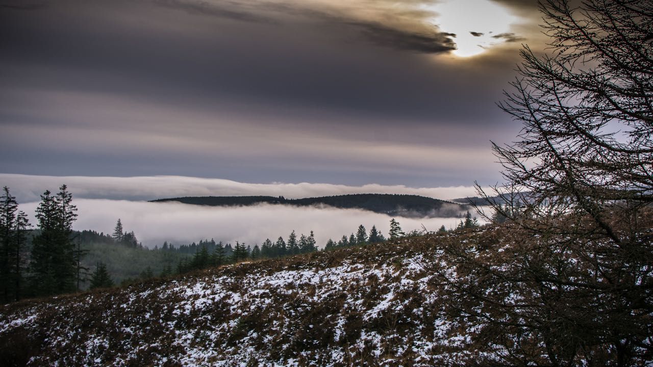
Beautiful Frosty Mornings in the Slieve Blooms
A remote and difficult, circular trail, starting and ending in Glenbarrow, County Laois, the Slieve Bloom Way is 52 miles long with an elevation of 4183 ft. It takes three days to complete and has designated wild camping areas. The Slieve Bloom mountains, rising from Ireland’s Central Plain can be seen from afar, their haunting presence always in the background.
The trail, although often on forestry tracks, passes through green glens with beautiful wildflowers, climbs heather-covered ridges, and traverses rough moorland.
10. The Bluestack Way
A view of the Bluestacks in Donegal
Of moderate difficulty, the Bluestack Way in County Donegal, northwest Ireland, connects Donegal with Ardara, Passing Lough Eske it traverses the Bluestack Mountains, a range of low hills, showcasing the stunning, savage scenery this remote area of Ireland has to offer. An ancient mountain graveyard at Disert makes an interesting stop before traversing over rough high moorland to Cloghmeen.
Walking mainly on bog tracks, moorland, and quiet back roads, this hike lasts two to three days; it is 40 miles long and relatively flat. Accommodation in the inhabited areas is very good, ensuring you get a good night's rest!
As you can see from this brief overview, Ireland is a fantastic walking destination and has a trail for every hiker! Just be prepared for rough terrain along with damp and windy weather and you won’t be disappointed! Recharge yourself with the scenic beauty and distant wildness that these trails offer and discover the stories and legends that make Ireland such an alluring place. Above all, enjoy yourself; find the Hiiker within!
Hiiker app is a great app for exploring long-distance hiking trails around the world and in Ireland. You'll find more than 1500 spectacular long-distance, with more than 40 in Ireland and more than 600 in North America.
Originally published in June 2021. Updated in November 2024.
This article was submitted to the IrishCentral contributors network by a member of the global Irish community. To become an IrishCentral contributor click here.
Comments