A medieval map depicting two islands off the coast of Wales provides some proof that the Celtic legend of Atlantis may be rooted in historical fact.
Simon Haslett, an honorary professor of physical geography at Swansea University, and David Willis, the Jesus Professor of Celtic at the University of Oxford, discovered the map, which is believed to be the oldest surviving complete map of the British and Irish Isles.
Dating back to the mid-13th century, the Gough map depicts two islands off Wales's Ceredigion coast.
Haslett told the BBC that the map is "extraordinarily accurate" considering the surveying tools available at the time.
Read more
"The two islands are clearly marked and may corroborate contemporary accounts of a lost land mentioned in the Black Book of Carmarthen," Haslett told the BBC.
Dr. Juliette Wood, a Welsh folklore expert at Cardiff University, told the BBC that the Black Book of Carmarthen was key in anchoring the story of a Celtic Atlantis in Welsh mythology.
"The Gough map may have its origins around 1280; shortly before that, around 1250, you have the Black Book of Carmarthen," Dr. Wood said.
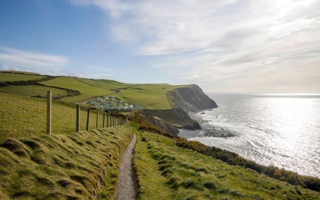
Stories of a Welsh Atlantis have been enshrined in legend for centuries, with many tales centering around a missing land beneath Cardigan Bay. The legendary sunken kingdom of Cantre’r Gwaelod is said to have been lost at some point during the post-glacial evolution.
Haslett and Willis used their understanding of the advance and retreat of glaciers and silt over the past 10,000 years to explain how the islands came into existence and then disappeared again.
They also used previous surveys of the bay, which suggest that the coastline was eight miles further west than it is today.
"I think the evidence for the islands, and possibly, therefore, the legends connected with them, is in two strands," Haslett said.
"Firstly, coordinates recorded by the Roman cartographer Ptolemy suggest that the coastline at the time may have been some eight miles further west than it is today.
"And, secondly, the evidence presented by the Gough map for the existence of two islands in Cardigan Bay."
Willis and Haslett, who discovered the map in Oxford University's Bodleian Library, said they intend to publish their findings in the Atlantic Geoscience journal.
,* Originally published in 2022, updated in Oct 2025.


Comments