Keem Bay on the westernmost tip of Achill Island is one of the most remote spots in Ireland.
Today, the beautiful valley is largely desolate, the boggy flanks of Croaghaun Mountain slope down to a sheltered white sandy beach. In summer campervans line up along the shorefront and holidaymakers brave the cold sea, but during the winter the place is abandoned to sheep, the occasional hiker, and the ferocious gales that lash the Atlantic coast. However, there is more to the site than meets the eye. If you leave the beach, clamber up the old hairpin bend road, past the early 20th-century coastguard station, you start to notice strange lumps and bumps in the grass. This is the site of a village of over forty houses that stood in the valley c.1838.
This forgotten village and its curious disappearance has been the subject of research by the Achill Archaeological Field School, based in Dooagh on Achill Island in County Mayo.
Dooagh beach, Achill.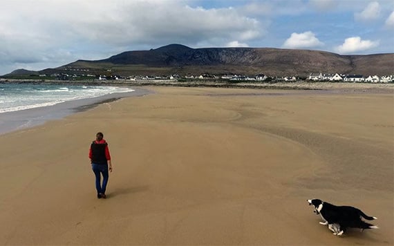
The Achill Field School, Ireland’s oldest, has been involved in research into the history and archaeology of the island since 1991. This research involved an extensive survey and excavation of selected sites carried out by staff and students of the Field School, the most notable of which was that of the world-famous Deserted Village at Slievemore. Following on from that, attention turned towards the prehistoric landscape of Slievemore, and the investigation of several premier Bronze Age sites, one of which produced a decorated pebble, a fine example of early representative art in Ireland.
In 2009, attention turned to the mysterious village in Keem. There is virtually no local memory of the village, but we know that in the decades before the Famine there was a vibrant community of about 40 houses here.
Keem Bay, Achill.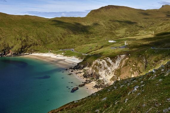
Today it is hard to imagine that such a settlement ever existed. All that remains above ground are some barely discernible grassy banks. The people who lived here left no written trace; their stories are obscured by time. We don’t know their names, what their lives were like, or what happened to them. Archaeology is a way of rescuing their stories, of piecing together their lives from the things they used and left behind.
The team of archaeologists from the AAFS was led to Keem by the trail of historical documents. The Ordnance Survey map, made in 1838, shows the cluster of small buildings that made up the village. The small brown rectangles on the map are scattered haphazardly across an area of about 275yds by 165yds on a shoulder of land beside a small stream.
The lumpy ground above Keem.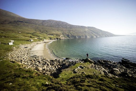
We know about the village too from accounts left by travel writers who visited Achill with increasing frequency from the 1830s. The island became a tourist magnet after the foundation of the Protestant Achill Mission c.1831 by the Reverend Edward Nangle. These accounts are heavily biased, viewing the local Achill people as primitive and backward, but they provide important clues about the site.
Over three summers our international team of students, including many from North America, painstakingly dug the site layer by layer, revealing the remains of the houses and the everyday belongings of their past inhabitants. As we sifted through the soil and made carefully measured drawings a picture of life in pre-Famine Keem began to emerge.

Love Irish history? Share your favorite stories with other history buffs in the IrishCentral History Facebook group.
The houses were snug. Much smaller than anything we would call home, with a single room and stout earth and drystone walls over a meter thick. The bigger house was about 23' by 10' and the smaller was just 19' by 8'.
The houses had rounded corners and a single door in the southwest looking to the soft boggy height of Moyteoge Head and the shimmering waters of Clew Bay beyond. There were no chimneys or stone fireplaces, but simple central hearths with the fire sitting directly on the earthen floor. Smoke from the peat fire would have wafted out the door and through the thatched roof of heather or scraws.
The interior of the houses would have been dim, lit by the soft glow of the peat fire and the warm beam of sunlight pouring in from the door. The bigger house had a stone-lined drain running out the door suggesting that cattle were probably kept in the house in winter. This was common practice in the west of Ireland in the 19th century.
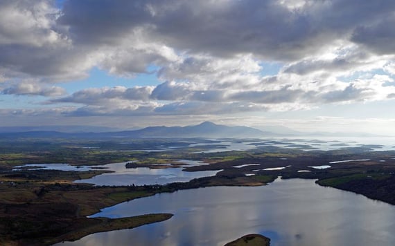
Clew Bay.
The hundreds of pieces of broken pottery we found show that the inhabitants of Keem adorned their homes with fine glazed earthenwares from the English potteries. We found cream-colored plates edged with vivid blue and green impressed shell designs, neat milk jugs with brown and black stripes, and bright orange and pink glazed vessels.
These typical early-19th-century ceramics are found across the globe from Inuit communities in the far north of the American continent to the homes of planters in the Caribbean. There may have been a dresser or perhaps a wall rack to display these valued ceramics.
Three glass beads were found at the site. These may have been from a broken rosary, small remnants of faith and belief. Lumps of violet amethyst crystal too were round in the houses. These were taken from a nearby quarry and sold to early nineteenth-century tourists by people in the village.
The houses were part of a tight-knit community that farmed the land together, growing potatoes and, perhaps oats, and rearing sturdy black cattle. In an arc surrounding the village, the tracks of their fields can be made out on the flanks of the mountains. Long, sinuous lines were carved into the boggy ground where the tubers were grown in raised ‘lazy beds.’
The excavations yielded clues to the end of the village. The rubble strewn around the inside of the houses clearly indicates that they were intentionally demolished and their stone carried off. The man credited with these demolitions is well-known to students of Irish history. Charles Boycott acquired the lease of Keem in 1855 from Murray McGregor Blacker, a tenant of the Achill Mission. He built a house in the Keem valley overlooking the site of the village.
It would seem, however, that the houses were abandoned before Boycott pillaged them for stone. A very poignant account of the village penned in 1852 by Harriet Martineau describes it as “a village of stone cottages, now becoming grass-grown, and silent as the death that laid it waste.” This account suggests that it was the Great Irish Famine of the 1840s that caused the abandonment of the village of Keem.
In 2017 the Achill Field School team will be returning to Keem to investigate another building in the settlement. We hope that the excavation will answer some of the many questions that remain about the site, and help to put the forgotten settlement back on the map.
* Eve Campbell an archaeologist working with the Achill Archaeological Field School, Co. Mayo, Ireland.
** Originally published in 2016, updated in Nov 2024.


Comments