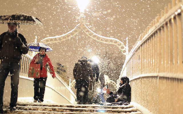
Watch Storm Emma, bringing the worst snow storm in 36 years and temperatures as low as 14F, live on radar
Storm Emma, dubbed “The Beast from the East”, fast approaching Ireland is set to bring the heaviest snowfall seen on the island in 36 years, with temperature dropping a low as 14F (-10C). You can watch the storm’s progress below with Windy.com’s live radar.
The Siberian blast has already hit mainland Europe, with France, Belgium and Germany experiencing temperature lows of 3.2F (-16C). The storm, driven to Ireland from the frigid north of Scandinavia and Russia, will bring snowfalls from 4 inches and drifts up to a meter deep.
Ireland’s meteorological center, Met Eireann, predict the worst of the storm will hit Ireland over Wednesday, Thursday and Friday. They are likely to issue a “Status Red” snow-ice alert.
The incoming storm is predicted to be the worst snow storm seen in Ireland since 1982 when 9.8 inches to 6.5 feet of snow fell across the country and about 100,000 homes and businesses were plunged into darkness. In 2010 Ireland also suffered a “Big Freeze”, which included a 10.6-inch snowfall on Christmas Day and the coldest winter on record since 1962/63.
Storm Emma is predicted to wreak as much havoc on the country. Watch Windy.com’s live radar below.
Currently there is a Status Orange Snow-Ice warning in seven counties - Dublin, Carlow, Kilare, Laois, Louth, Wicklow and Meath. It is likely that a “red alert” will be in operation across the country by Wednesday.
The orange warning reads:
“Air and ground temperatures will be 5 to 10 degrees [Celsius] below normal, with significant wind chill and penetrating severe frosts.
“Snow showers, mainly affecting eastern areas on Tuesday, will progressively become more widespread and heavier through midweek.
“A spell of persistent and heavy snow is expected to extend from the south late Thursday and Thursday night, with significant and disruptive accumulations.”
Forecaster Evelyn Cusack told Newstalk Breakfast that counties in the east and south of Ireland will be under a "blanket of snow" by Thursday.
"Thursday will be the worst day, and it's not going to be a nice weekend either. I don't want to discount the showers tonight and tomorrow. We're worried about the winds, and there is also the possibility of thunder and lightning with Storm Emma,” said Cusack.
"Overall, the west and northwest will fair best. The east and south, they will more than likely be a blanket of snow by Thursday."
'Beast from the East': Watch LIVE and track the predicted path of Storm Emma across Ireland See the latest weather updates on Independent.ie: http://indo.ie/7Nxj30iDtrU
Posted by Independent.ie on Monday, February 26, 2018
Ireland is bracing for transport chaos, school closures, and disruption to supermarket supplies.
Dublin Airport will have more than 100 machines dedicated to de-icing and clearing snow. However Irish government sources told the Irish Independent that there is a “strong chance” flights will be grounded at some point this week.
Widespread school closures are expected on Thursday and Friday as over 116,000 children would not make it to school due to transport disruption.
The government have announced that the Defence Forces will be on standby to support the emergency services. The Irish Red Cross, Irish Coastguard and Air Corps will be on standby to aid with any medical cases in areas which are inaccessible due to ice and snow.
Taoiseach Leo Varadkar urged people to follow safety advice.
The Irish leader said “I would ask people to pay very close attention to any weather warnings and advice that is issued in the coming days. We will either be asking people to stay at home and not to make unnecessary journeys or, if they are in work already, to stay in work and not to make unnecessary journeys.”
Read more: "The Night Of The Big Wind" that killed 90 took place on this date in 1839


Comments