Storm Agnes is tracking northeastwards over Ireland with further disruption likely in places, Met Éireann said on Wednesday afternoon.
The Irish National Meteorological Service said it will be "very windy with strong to gale force southeasterly winds, veering southwesterly through the rest of the day."
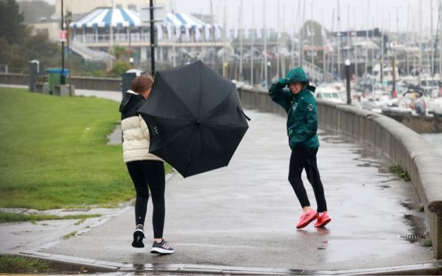
Further outbreaks of rain will mean more localized flooding is possible, Met Éireann added, while strong onshore winds and high seas will bring the risk of coastal flooding on Ireland's eastern and southern coasts.
It will be staying windy for a time on Wednesday night in the north and east with strong and gusty southwesterly winds gradually easing as Storm Agnes clears towards Scotland.
Outbreaks of rain in the northeast will give way to a mix of clear spells and scattered showers on Wednesday night. Lowest temperatures of 9 to 12 degrees.
#StormAgnes
Windy tonight, with strong & gusty westerly winds gradually easing & backing southwesterly as StormAgnes clears towards Scotland?️Showers will also clear early in the night with some clear spells developing?️☁️
More ⬇️https://t.co/yEsIuCkWlq pic.twitter.com/TUi0vBqi3H
— Met Éireann (@MetEireann) September 27, 2023
With Storm Agnes tracking over Ireland, several weather warnings are in place, some through Thursday morning.
A Status Yellow rain warning is in Counties Carlow, Dublin, Kilkenny, Wexford, Wicklow, Cork, Kerry, and Waterford until midnight tonight.
Potential impacts associated with the Status Yellow rain warning include difficult travel conditions, localized flooding, and poor visibility.
The harsh conditions proved difficult for Stephen Murphy of Sky News, who was reporting from Tramore, Co Waterford:
Sky's @SMurphyTV tries valiantly to report from Ireland as Storm Agnes moves in, but the heavy rain and high wind is too much for the equipment?️
Live updates on Storm Agnes? https://t.co/C5RuAQWecI pic.twitter.com/OF46RYNhyt
— Sky News (@SkyNews) September 27, 2023
A Status Yellow wind warning is also in place for Leinster, Munster, and Galway through midnight tonight.
Met Éireann said it will be "becoming very windy on Wednesday with very strong and gusty southerly winds, veering westerly later on."
Potential impacts include coastal flooding, difficult travel conditions, power outages, and some fallen trees.
#StormAgnes has arrived in Clonakilty Bay with driving rain accompanying the wind. pic.twitter.com/XJaTAG0uiE
— WalterDog (@WalterofWexford) September 27, 2023
A Status Orange wind warning for Counties Carlow, Kilkenny, Wexford, Wicklow, Cork, Kerry, Tipperary, and Waterford expired at 7 pm on Wednesday.
Cork Safety Alerts shared this dramatic video of a roof being ripped from a building at Youghal Strand on Wednesday:
A roof has just come off a building at Youghal Strand. Emergency services are en route. Avoid the area if possible! #StormAgnes pic.twitter.com/3Kn8HPTrRD
— Cork Safety Alerts (@CorkSafetyAlert) September 27, 2023
Meanwhile, all six counties in Northern Ireland are under a Yellow Rain Warning until 8 pm on Wednesday and a Yellow Wind Warning until 7 am on Thursday.
UTV News shared this footage of a plane approaching Belfast Airport in the windy conditions:
WATCH: Plane battles Storm Agnes to land at Belfast City Airporthttps://t.co/Uz6kAzk0ZS pic.twitter.com/VNrSgBCvRH
— UTV Live News (@UTVNews) September 27, 2023
Met Éireann predicted Storm Agnes would make landfall in Ireland on Wednesday after it was named by the UK Met Office on the morning of Monday, September 25.


Comments