
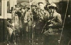
‘Island: Drawing Conclusions Mapping the Irish’ is an exploration of the history of Ireland through a series of maps, atlases, postcards, cartoons, and pamphlet spanning from the 2nd century to the 21st century. A collaboration between four outstanding collections, Island is poised to be a fascinating look at the political and cultural history of Ireland.
The American Irish Historical Society in collaboration with Mayo County Council’s Jackie Clarke Collection: Ireland’s Memory, the Linen Hall Library and The Norman B. Leventhal Map Center at the Boston Public Library, will unveil the exhibition on June 12 at the AIHS.
As Vincent Virga of the Jackie Clarke Collection explains: “The subject of maps is fourfold: people, society, culture, and history. Each map is a set of visual clues revealing why it was made and how it was used. Each map expresses a social and political interest, of which there are many. Thus maps are acts of discernment. Because they organize knowledge visually, maps are rooted in our visual culture.”
As cartographic historian, Christian Jacob explains, “They share a set of codes – geometric, chromatic, figurative, aesthetic- with painting and drawing, book illustration, calligraphy and architecture.”
“Being works of art, they are uniquely human and reveal the collective values of a community. And as a primary source in the history of the imagination, a singular dimension of history. Yet these cultural landscapes have always been expendable; discarded for newer ones, shattered and burned in wars, destroyed for reasons of national security, decimated by time. This makes mapping civilizations an ongoing journey of discovery involved many diverse disciples.”
This exhibition is open to the public June 13 – July 12, Monday – Friday 10- 5 at the American Irish Historical Society , 991 Fifth Avenue. New York, NY 10028.


Comments